Stick to the Facts
Add Nbsla.ca as a Preferred Source on Google to see more of our stories in your search results.
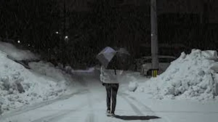
Southern Ontario is waking up to a cold and unusually sharp start to the day, with temperatures dipping close to winter-like levels despite the calendar firmly sitting in spring. While May is typically associated with blooming flowers, mild mornings, and steadily warming afternoons, this particular weather pattern is reminding residents that spring in the region does not always arrive in a straight line.
Early morning conditions are expected to feel significantly colder than seasonal norms, with “feels like” temperatures dropping to around minus one degree Celsius around 7 a.m. in some locations. That kind of reading is more typical of late March or early April rather than early May, and it has raised concerns about frost formation in vulnerable and exposed areas across southern Ontario.
This cold snap is not isolated to a single city. It stretches across a wide and heavily populated corridor, affecting communities including Toronto, Mississauga, Brampton, Oakville, Milton, Burlington, Hamilton, Niagara Region, Oshawa, Pickering, and Whitby. In short, much of the Greater Toronto and Hamilton Area and surrounding regions are experiencing the same unseasonably chilly start.
Widespread Frost Risk Across Urban and Rural Areas
Patchy Frost Development in Low-Lying Zones
One of the main concerns during this cold morning pattern is the development of patchy frost. As temperatures dip to or below the freezing mark in certain pockets, frost formation becomes increasingly likely, especially in areas that are naturally more exposed to cold air drainage.
Low-lying regions, open fields, rural outskirts, and areas away from dense urban infrastructure tend to cool more rapidly overnight. These conditions create ideal environments for frost to form even when nearby urban centers remain slightly warmer.
In suburban neighborhoods with large green spaces, parks, and gardens, frost risk can still be present. Even within cities like Toronto or Hamilton, localized microclimates can lead to surprising temperature differences from one street to another.
Why Urban Areas Are Not Fully Protected
Although cities generally retain heat better than rural zones due to buildings, pavement, and human activity, early May cold snaps can still produce frost in urban environments under the right conditions.
Clear skies overnight allow heat to escape rapidly into the atmosphere. When combined with calm winds and dry air, surface temperatures can drop quickly, allowing frost to form on cars, rooftops, lawns, and garden plants.
This is why residents across the entire region are being advised to remain alert, even if they live in densely populated areas where frost might not seem likely at first glance.
Understanding Why May Frost Still Happens in Southern Ontario
Historical Weather Patterns in Early Spring
While this cold morning may feel unexpected, it is not entirely unusual for southern Ontario. The region sits in a transitional climate zone where spring warmth can be interrupted by late-season cold air masses.
Historically, the final frost in Toronto and surrounding areas often occurs around early to mid-May. In fact, climatological records show that Toronto’s average last frost date is approximately May 4. This means that frost risk in early May is still part of the natural seasonal cycle, even if it feels out of place.
In some years, frost events have even extended into mid or late May in certain parts of Ontario, particularly in rural or elevated areas. This variability is a key feature of the region’s climate.
Why This Year Feels Colder Than Expected
Even though frost in early May is not unprecedented, the intensity of the cold can still feel surprising. Overnight lows in early May are usually well above freezing, and many residents expect consistent spring warmth by this point.
When temperatures drop close to zero or below, especially with wind chill making it feel like minus one or lower, the contrast becomes more noticeable. This is particularly true after stretches of milder weather earlier in the season.
The result is a sharper-than-usual reminder that seasonal transitions in Ontario are gradual and often inconsistent.
Areas Most Affected by the Cold Morning
Greater Toronto Area and Surrounding Communities
The Greater Toronto Area is among the most impacted regions during this cold snap. Cities such as Toronto, Mississauga, Brampton, Oakville, Milton, and Burlington are all experiencing similar early morning temperature drops.
In these areas, frost is most likely to appear on grassy surfaces, vehicle windshields, and exposed outdoor plants. While urban heat retention may reduce widespread frost coverage, localized patches are still possible.
Hamilton and Niagara Region Cold Exposure
Hamilton and the Niagara Region are also seeing significant early morning chill. The geography of these areas, including nearby escarpments and open agricultural land, can contribute to cooler overnight conditions.
In Niagara’s rural and vineyard regions, frost risk is particularly important due to the sensitivity of early-season crops and budding vines.
Eastern GTA Communities
Oshawa, Pickering, and Whitby are also within the frost advisory zone. These communities often experience slightly cooler nighttime temperatures compared to downtown Toronto due to their proximity to open land and Lake Ontario’s moderating influence, which can vary depending on wind direction and cloud cover.
Potential Impacts on Plants, Gardens, and Agriculture
Risk to Early-Season Garden Plants
One of the most immediate concerns during a frost event in May is damage to vegetation. Many homeowners have already begun planting flowers, vegetables, and herbs in outdoor gardens, assuming that the risk of frost has passed.
However, cold overnight temperatures can cause significant stress or damage to tender plants. Leaves may become discolored, wilted, or blackened after exposure to freezing conditions. Young seedlings are particularly vulnerable because they lack the resilience of more established plants.
Budding Trees and Landscaping Concerns
Even trees and shrubs that are in early stages of leaf development can be affected. Budding leaves are delicate, and sudden exposure to frost can slow growth or cause partial damage.
Ornamental plants used in landscaping around homes, parks, and public spaces may also show signs of stress after a cold night.
Agricultural Implications in Rural Areas
For farmers and agricultural producers, early May frost events can be especially concerning. Crops that are in early growth stages may suffer damage depending on their sensitivity and exposure.
Fields in low-lying rural areas are particularly vulnerable, as cold air tends to settle in these zones overnight. Protective measures such as frost covers, irrigation systems, or wind machines may be used in some agricultural settings to reduce damage.
Why “Feels Like” Temperatures Matter More Than Actual Readings
Wind Chill and Perceived Cold
The “feels like” temperature is an important factor in understanding how cold conditions affect both people and plants. Even if the actual air temperature hovers near freezing, wind can make it feel colder by accelerating heat loss from surfaces.
A “feels like” reading near minus one degree Celsius at 7 a.m. indicates that exposed surfaces are experiencing conditions capable of producing frost, even if official air temperature readings are slightly higher.
Ground-Level Cooling Effects
Frost formation is heavily influenced by ground-level temperatures rather than just air temperature readings. On clear, calm nights, heat radiates from the surface of the Earth into the atmosphere, allowing ground temperatures to drop below freezing even when air temperatures remain marginally above zero.
This is why frost can form in gardens and fields even when weather forecasts suggest only near-freezing conditions.
What Residents Should Expect Through the Morning
Gradual Warming After Sunrise
As the sun rises higher in the sky, temperatures are expected to gradually recover. Early morning frost, if it forms, typically begins to melt shortly after sunrise as solar radiation increases.
By late morning, most affected areas should return to more typical spring conditions, with milder temperatures and improved comfort levels.
Clear Skies and Calm Winds
Conditions that support frost formation often include clear skies and light winds. These same conditions also allow for quick warming once the sun is up, leading to a sharp contrast between early morning chill and midday warmth.
Practical Steps to Protect Plants and Outdoor Spaces
Covering Sensitive Vegetation
Residents with gardens are encouraged to take simple protective measures during frost-prone mornings. Covering plants with cloth sheets, garden blankets, or frost covers can help trap heat from the ground and reduce damage.
Moving Potted Plants Indoors
Potted plants are especially vulnerable because their roots are more exposed to cold air. Bringing them indoors or placing them in sheltered areas such as garages or porches can help protect them from frost exposure.
Watering Soil Before Cold Nights
Moist soil retains heat more effectively than dry soil. Light watering during the afternoon before a cold night can sometimes help reduce frost risk in garden beds.
A Reminder of Southern Ontario’s Unpredictable Spring Weather
Seasonal Transition Is Never Linear
This early May cold snap serves as a reminder that spring in southern Ontario is a gradual transition rather than a fixed shift. Warm days can quickly be followed by cold mornings, and frost risk can linger longer than many residents expect.
Preparing for Ongoing Temperature Swings
Even as the region moves deeper into May, occasional cool nights remain possible. Gardeners, farmers, and homeowners benefit from staying aware of weather forecasts and being prepared for sudden temperature changes.
Final Outlook
While the current cold morning conditions may feel surprising, they remain within the broader range of historical weather patterns for southern Ontario. Frost in early May is not uncommon, but it can still have noticeable impacts on plants, crops, and outdoor environments.