Stick to the Facts
Add Nbsla.ca as a Preferred Source on Google to see more of our stories in your search results.
A powerful late-season winter system is moving across Colorado, triggering a Colorado I-25 snow warning, along with a winter storm watch, winter storm warning, and winter weather advisory for different regions across the state. The storm is expected to bring heavy snowfall, hazardous road conditions, and widespread travel disruptions along major routes, including Interstate 25, which connects Colorado Springs, Denver, and Fort Collins.
This snow storm weather forecast comes at a time when much of Colorado was already dealing with drought conditions, making the incoming snowfall both significant and disruptive.
Major Winter Storm Targets Colorado
According to the latest weather forecast snow storm outlook from meteorologists, a strong system will impact the Rocky Mountains and surrounding plains through midweek, with the heaviest snow expected on Tuesday and Wednesday.
The National Weather Service in Boulder noted that this could become one of the most significant snow events of the season in terms of moisture content.
Meteorologists emphasized that while late-season snow is not unusual in Colorado, the intensity of this system stands out due to its potential accumulation and timing.
Denver Snow Storm Warning Looms as Heavy Midweek System Targets City
Snowfall Forecast: Mountains and Denver Impact
The storm is expected to produce sharply different conditions depending on elevation:
Mountain Regions
- Up to 2 feet of snow expected in higher elevations
- Locally higher amounts possible in some mountain zones
- Heaviest snowfall concentrated in the central and northern Rockies
Denver and I-25 Corridor
- Several inches of snow possible across Denver
- Fluctuating conditions depending on storm track
- Wet, heavy snow expected, increasing risk of power outages and tree damage
In some scenarios, forecasters warn that Denver could see closer to an inch or more, while mountain areas could exceed a foot or even approach three feet in isolated spots.
Winter Storm Watch, Warning, and Advisory Explained
Different alerts are currently active across Colorado:
Winter Storm Watch
A winter storm watch means conditions are favorable for heavy snow, strong winds, and travel disruptions. This is issued ahead of the storm when confidence in impact is high but timing and intensity may still change.
Winter Storm Warning
A winter storm warning indicates that dangerous snow conditions are expected. This includes heavy snowfall rates, reduced visibility, and hazardous road conditions.
Winter Weather Advisory
A winter weather advisory is issued for lighter but still impactful snow, often leading to slick roads and minor travel delays.
Colorado I-25 Snow Warning: Travel Risk Across Major Corridor
The Colorado I-25 snow warning is especially important for commuters and freight transport. Interstate 25 is one of the busiest north-south highways in the state, and even moderate snowfall can quickly lead to:
- Slow-moving traffic and long delays
- Increased accident risk due to icy surfaces
- Reduced visibility during peak snowfall
- Possible road closures in extreme sections
Officials are urging drivers to avoid unnecessary travel during peak storm hours, especially Tuesday afternoon and evening when conditions are expected to worsen.
Denver Weather: What Residents Should Expect
The latest Denver weather forecast suggests a mix of snow intensity levels, depending on how the storm tracks eastward.
Key expectations for the metro area:
- Wet, heavy snow accumulation on roads and sidewalks
- Slushy conditions during daytime hours
- Rapid temperature changes affecting refreezing overnight
- Possible power interruptions due to tree damage
Xcel Energy has already stated that extra crews are on standby in case of outages caused by heavy snow weighing down tree branches.
Impact on Trees, Power, and Infrastructure
One of the major concerns with this system is the weight of wet snow falling on trees that have already begun spring growth.
Meteorologists warn:
- Broken tree branches are likely
- Localized power outages may occur
- Cleanup efforts may extend several days after the storm
Because foliage is already developing in many areas, the snow is expected to cling more heavily to branches than in mid-winter storms.
Travel Advisory: Why This Storm Is Dangerous
Officials describe this weather forecast snow storm as a “major travel concern,” especially along mountain passes and highway corridors.
Drivers may face:
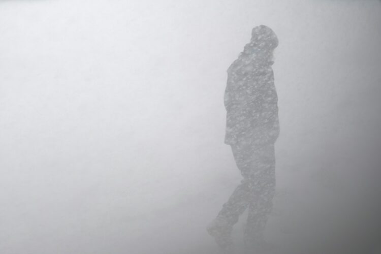
- Sudden whiteout conditions
- Black ice during early morning and evening hours
- Rapidly changing road surfaces
- Chain restrictions in mountain areas
Even short trips could become hazardous during peak snowfall periods.
Broader Context: Snow After a Dry Winter
This storm arrives after a season marked by unusually dry conditions across Colorado. Nearly 60 percent of the state was recently classified under severe drought categories, making this snowfall both significant and unusual for late spring timing.
While the storm will not fully reverse drought conditions, it may provide:
- Short-term improvement in snowpack levels
- Some relief to mountain water reserves
- A temporary boost to ski-area snow coverage
The combination of a winter storm watch, winter storm warning, and winter weather advisory highlights how widespread this system is expected to be. From the mountains to the Denver metro area and along the Colorado I-25 snow warning corridor, residents should prepare for rapidly changing conditions.
The storm is expected to peak midweek, with gradual improvement afterward, but lingering impacts on roads, travel, and infrastructure may continue for several days.
For the most updated Denver weather and statewide alerts, residents should follow official National Weather Service updates as conditions evolve quickly.