Stick to the Facts
Add Nbsla.ca as a Preferred Source on Google to see more of our stories in your search results.
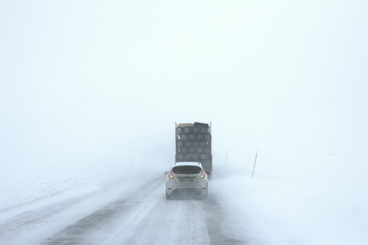
A powerful snow storm warning is shaping up across Colorado this week, bringing a dramatic shift from warm spring weather to cold, snowy conditions. After one last mild day, the Denver metro area and surrounding regions are preparing for a multi-day system that could deliver heavy snowfall, hazardous travel, and rapidly changing conditions.
Calm Before the Snow Storm Warning
Sunday remains relatively quiet across the Front Range, offering a brief window of calm weather before the incoming system. Temperatures are comfortable, skies stay mostly dry, and there are no major disruptions expected. However, this is simply the calm before a significant snow storm warning takes hold.
Monday: Transition Into Active Weather
Monday marks the beginning of the weather shift. The day will start mild, but conditions will gradually become more unstable. By afternoon, scattered rain showers and isolated thunderstorms are expected to develop, first over the mountains and then spreading into the plains.
By evening, a cold front pushes into the region, setting the stage for a widespread snow storm warning. This is when temperatures begin to drop and precipitation starts transitioning toward snow, especially in higher elevations.
Snow Storm Warning Intensifies Monday Night Through Wednesday
From Monday night through Wednesday, the snow storm warning becomes the main concern across Colorado. This system is expected to bring significant snowfall, particularly to the Front Range mountains and foothills.
- Higher elevations could see over a foot of snow, with some areas potentially receiving even more.
- Snowfall rates may become intense late Tuesday into early Wednesday, increasing the risk of difficult or dangerous travel.
- Mountain roads could turn slick and hazardous, especially during peak snowfall periods.
This snow storm warning is notable because it arrives during spring, when trees have already leafed out. Wet, heavy snow accumulating on branches could lead to localized power outages and damage.
Denver and I-25 Corridor: Snow Likely, But Totals Uncertain
For Denver and areas along the I-25 corridor, confidence is growing that this snow storm warning will bring measurable snowfall. The key uncertainty remains how much snow will actually stick.
- Several inches of snow are possible across the metro area
- The best chance for accumulation will be Tuesday night into Wednesday
- Heavier snow bands could lead to higher totals in localized areas
Because ground temperatures have been warmer, early snowfall may melt on contact. However, as colder air settles in, accumulation becomes more likely, reinforcing the seriousness of this snow storm warning.
Impact on Travel and Daily Life
The developing snow storm warning could disrupt travel across much of Colorado:
- Mountain passes may become dangerous or temporarily impassable
- Wet, heavy snow could create slushy and slick roads in Denver
- Reduced visibility and changing road conditions may impact commutes
Residents are advised to stay updated on forecasts and plan ahead as the snow storm warning evolves.
Quick Warm-Up After the Snow Storm Warning
The good news is that this system won’t linger for long. By the second half of the week, the snow storm warning conditions will begin to fade:
- Cold air moves out of the region
- Temperatures rebound to near or above seasonal averages
- Weather becomes calmer with only a slight chance of passing showers
This rapid turnaround is typical of spring in Colorado, where weather patterns can shift quickly.
This upcoming snow storm warning is a classic example of Colorado’s unpredictable spring weather. While the storm will bring needed moisture, it also carries the potential for travel disruptions, heavy snow, and localized impacts.
Residents in Denver, the foothills, and mountain areas should stay alert, monitor updates, and prepare for rapidly changing conditions as this snow storm warning moves through the region.