Stick to the Facts
Add Nbsla.ca as a Preferred Source on Google to see more of our stories in your search results.
A dangerous Winter Storm Warning is now in effect across large parts of Southwest Alaska as a massive Pacific weather system barrels toward the region this weekend. Forecasters are warning that the powerful Alaska winter storm could bring up to 13 inches of snow, freezing rain, and destructive 90 MPH winds capable of creating life-threatening travel conditions from late Saturday into Sunday morning.
The latest alerts from National Weather Service Anchorage describe the approaching system as a high-impact weather event with overlapping High Wind Warnings and Winter Weather Advisories already posted for several communities across the Alaska Peninsula, Eastern Aleutians, Bristol Bay, and the Kuskokwim Delta.
Residents are being urged to prepare immediately as the combination of heavy snow, hurricane-force wind gusts, and icy roads could create extremely dangerous conditions through Sunday morning.
90 MPH Winds Could Create Blizzard-Like Conditions
The most alarming part of this Alaska winter storm is the forecast for extreme winds. According to meteorologists, the Alaska Peninsula channels may experience wind gusts reaching an incredible 90 miles per hour, strong enough to damage structures, knock down power lines, and push vehicles off roads.
Other areas are also expected to face severe conditions:
- Eastern Aleutians and Pribilof Islands: wind gusts up to 80 MPH
- Kuskokwim Delta Coast: gusts reaching 75 MPH
- Coastal and exposed areas: blowing snow and near-whiteout visibility
The National Weather Service said confidence in the damaging wind forecast remains high, making this one of the strongest storms to impact Southwest Alaska this season.
Heavy Snowfall Totals Expected Across Southwest Alaska
In addition to the powerful winds, the Winter Storm Warning includes major snowfall accumulations across multiple regions.
Forecast snow totals include:
- Lower Kuskokwim Valley: 9 to 13 inches of snow
- Bristol Bay north of King Salmon: 8 to 12 inches
- Interior portions of Southwest Alaska: several inches of blowing and drifting snow
The heavy snowfall combined with intense crosswinds could quickly create blizzard-like conditions on highways and local roads. Snowdrifts may reduce visibility to near zero in some exposed coastal communities.
Meteorologists warn that snowfall rates could intensify late Saturday night as the core of the Pacific storm system moves inland.
Freezing Rain Adds Another Dangerous Layer
The Alaska winter storm is not just bringing snow. Parts of the Kuskokwim Delta Coast are expected to experience a dangerous mix of snow and freezing rain.
Freezing rain is especially hazardous because it creates nearly invisible layers of ice on roads, sidewalks, and bridges. Even a thin glaze can make travel extremely dangerous for drivers and pedestrians.
Officials warn that icy surfaces combined with hurricane-force winds could make vehicle control nearly impossible in exposed areas.
Peak Danger Window: Late Saturday Through Sunday Morning
Weather experts say the most dangerous conditions are expected during a critical period from late Saturday night through early Sunday morning.
During this timeframe:
- Wind gusts may reach their maximum strength
- Snowfall rates could intensify
- Freezing rain may spread across coastal zones
- Visibility could collapse suddenly in blowing snow
- Road conditions may deteriorate rapidly
Drivers traveling during the overnight hours into Sunday morning face the highest risk of accidents and road closures.
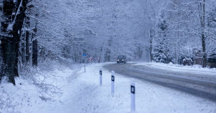
Roads Across Southwest Alaska May Become Extremely Hazardous
Several key transportation routes and community road systems could be heavily impacted by the storm.
Areas expected to face dangerous travel include:
- Bethel’s paved road network
- King Salmon to Naknek roadway connections
- Unalaska local roads and exposed coastal segments
- Open stretches along the Alaska Peninsula
The National Weather Service warned that vehicles, especially trucks, vans, SUVs, and semis, could be pushed sideways by crosswinds exceeding hurricane-force levels.
Authorities are encouraging residents to check current conditions through Alaska 511 before attempting travel.
Winter Storm Warning Raises Concerns About Power Outages
Strong winds near 90 MPH may also trigger scattered power outages across vulnerable coastal communities.
Heavy snow accumulation on power infrastructure combined with violent gusts can increase the risk of:
- Downed power lines
- Communication interruptions
- Tree damage
- Isolated utility failures
Emergency crews may face difficult conditions if roads become blocked by snowdrifts or ice accumulation.
Residents are advised to fully charge phones, backup batteries, and emergency power banks before conditions worsen.
Dangerous Alaska Winter Storm Could Impact Air and Marine Travel
The severe weather system may also disrupt regional flights and marine transportation across Southwest Alaska.
Airports in storm-affected communities could experience:
- Delays
- Flight cancellations
- Reduced visibility for landing operations
- Dangerous crosswind conditions
Marine conditions are expected to become extremely rough as hurricane-force gusts move across coastal waters and the Bering Sea region.
Winter Driving Safety Tips During the Alaska Storm
Officials strongly recommend avoiding unnecessary travel during the peak storm period. If travel cannot be postponed, drivers should take extra precautions.
Important Winter Storm Driving Tips
- Slow down well below the speed limit
- Keep both hands firmly on the steering wheel
- Increase following distance significantly
- Avoid sudden braking or sharp steering movements
- Never use cruise control on icy roads
- Watch for strong crosswinds near open coastlines
- Stay alert for blowing snow reducing visibility
Drivers should also ensure vehicles are equipped with proper winter tires rated for snow and ice conditions.
Emergency Winter Kits Could Save Lives
Emergency officials say every vehicle should carry a winter survival kit during this dangerous weather event.
Recommended emergency supplies include:
- Water and snacks
- Blankets and layered clothing
- Flashlights and batteries
- Phone chargers or power banks
- Ice scrapers and snow brushes
- Tire traction aids
- First aid supplies
In severe winter storms, stranded motorists can face rapidly dropping temperatures and dangerous wind chills.
Conditions Expected to Improve Sunday Afternoon
Forecasters expect the storm system to gradually weaken and shift eastward by Sunday afternoon. However, lingering wind gusts, drifting snow, and refreezing roads may continue creating hazards into Monday across parts of coastal Alaska.
Meteorologists are also monitoring another Pacific storm system developing behind this one, raising concerns that additional winter weather could impact the region again next week.
Residents across Southwest Alaska are encouraged to stay updated with the latest Winter Storm Warning information and prepare now before conditions rapidly worsen this weekend.