Stick to the Facts
Add Nbsla.ca as a Preferred Source on Google to see more of our stories in your search results.
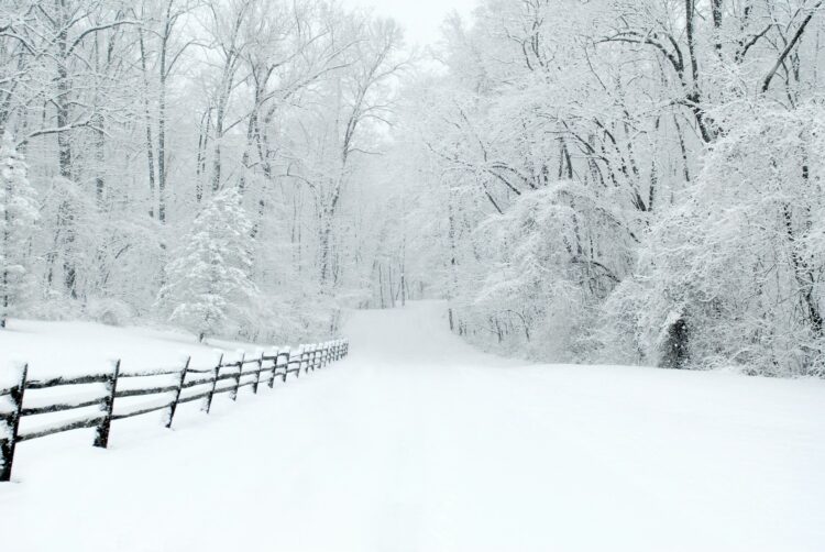
A powerful late-season winter storm is rapidly building across the western United States, bringing dangerous travel conditions, heavy snowfall, and strong winds that could disrupt major highways and mountain passes over the next several days.
According to the National Weather Service, this developing winter storm is targeting the Sierra Nevada with unusually high moisture levels for this time of year. Meteorologists warn that snowfall totals could reach up to four feet at higher elevations, while strong wind gusts may exceed 70 mph, creating near-blizzard conditions in exposed areas.
Peak Impact Window for This Winter Storm
The most dangerous period of this winter storm is expected from Sunday night through Tuesday morning. During this time, rapidly falling snow levels will catch many drivers off guard, especially in areas that typically see milder conditions in early May.
Snow levels are forecast to drop sharply from around 7,000 feet to nearly 4,500 feet, increasing the risk of icy roads and hazardous driving conditions even at lower elevations.
Highways at Risk During the Winter Storm
Several key transportation routes are expected to be heavily impacted by this winter storm, including:
- Interstate 80 over Donner Pass
- Highway 50 over Echo Summit
- Highway 395 along the Eastern Sierra
These routes could see chain controls, major delays, and even temporary closures as the winter storm intensifies. Officials warn that if multiple passes shut down at once, there may be no viable alternate routes across the central Sierra.
What This Winter Storm Could Bring
Forecasters outline several major threats tied to this winter storm:
- Heavy snowfall: 1 to 2 feet above 6,000 feet, with up to 4 feet at higher peaks
- Strong winds: Sustained gusts between 50 and 70 mph, possibly higher along ridge lines
- Rapid temperature drops: Leading to icy conditions overnight
- Reduced visibility: Blowing snow could create whiteout conditions in exposed areas
Travel Risks and Safety During the Winter Storm
Authorities stress that this winter storm is not typical for May and could pose serious risks for unprepared drivers. Chain requirements will likely be enforced for most vehicles traveling above 5,000 feet, and even all-wheel-drive vehicles may be required to carry chains.
Anyone planning to travel through affected regions should prepare for delays and rapidly changing conditions. Essential items include:
- Tire chains
- Warm blankets
- Flashlights and portable chargers
- Food and water
- A full tank of fuel
Checking real-time road updates before traveling is strongly advised, as conditions during this winter storm can shift quickly.
Why This Winter Storm Is Unusual
Late-season systems like this winter storm are relatively rare but not unheard of. What makes this event stand out is the combination of high moisture levels and strong Pacific dynamics, which are more typical of mid-winter patterns.
This setup increases the likelihood of intense snowfall rates and powerful winds, creating conditions that resemble peak winter rather than spring.
This incoming winter storm is shaping up to be one of the most significant late-season weather events in recent years for the Sierra Nevada region. With heavy snow, strong winds, and dangerous travel conditions expected, officials are urging caution and preparedness.
If you don’t absolutely need to travel during the peak of this winter storm, it may be safest to delay your plans until conditions improve.